Petrus Steyn
 Well, the town has just been renamed by the ANC (December 2012), it is now Mamafubedu, but I will ignore this. For me it stays Petrus Steyn. Its geographic position: 27.6411°S, 28.1318°E and 1717 m altitude.
History
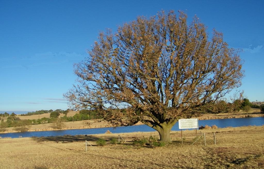
Petrus Steyn was founded in 1912 on the farm owned by the widow of Petrus Steyn. She sold it on condition that the town be named after him. Here the picture of his grave. This is all explained on the board placed at the graves, I'll translate for those that can't read Afrikaans:
Grave of Petrus Steyn
The owner of the farm on which the village was established
The new village was supposed to be called Concordia. The widow of Mr Steyn was prepared to reduce the price by seven shilling and 5 pence per morgen provided that the town will be named after her late husband.
 The farm Sterkfontein was thus purchased from the estate of the late Petrus Paulus Steyn for £4.50 per morgen. Thus on the 11 October 1912 Petrus Steyn was laid out.
The late Mr and Mrs Steyn were born on the 23 June 1842 and 31 October 1842 respectively and died on the 7 November 1897 and 9 June 1928. The late Mr Steyn grave is in the family grave yard under this oak tree. The late Mrs Steyn was buried in Bothaville.
NG church

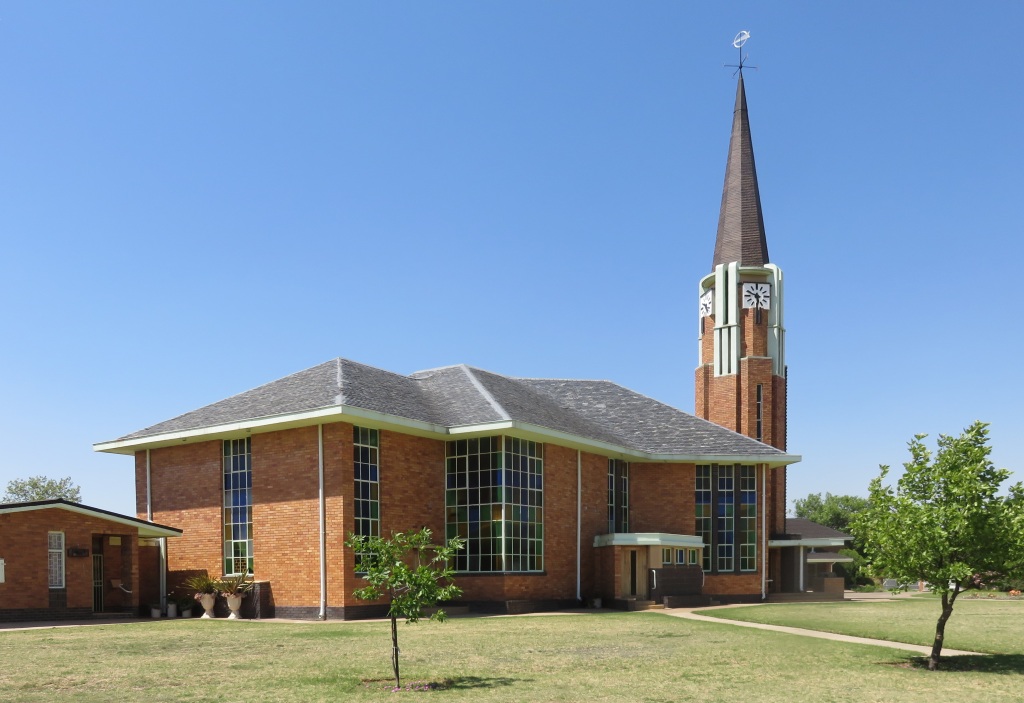 Soon after the founding of the town enough members of the NG church were in the area to have their own congregation. This was not by ceding from an other congregation, but rather by carving bits from surrounding congregations, that was Lindley, Reitz, Frankfort and Heilbron.
The first church was a sand stone building which was inaugurated on the 19-May-1917, that is the picture on the left. Later two wings were added making it a cruciform church, that was 1924. With time also the enlarged church became too small and a new modern church was built in 1946. This church is still standing and in use today.
the English church
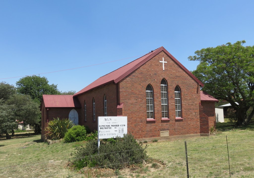
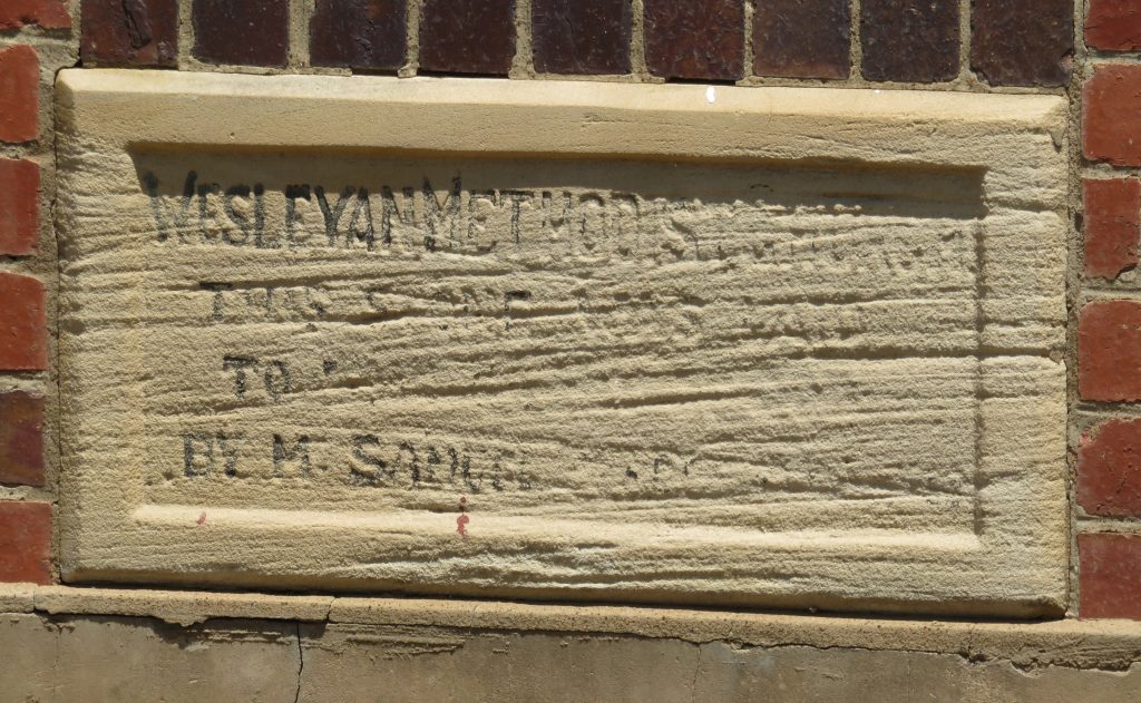 Locally it's known as 'die Engelse kerk' (the English church), but it is an Afrikaans church now, the AGS. The foundation stone can only be read partially, what I can make out is: 'Wesleyan Methodist Church, this stone was laid; to ....????.'.
Kruispad Kerkie
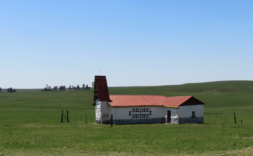
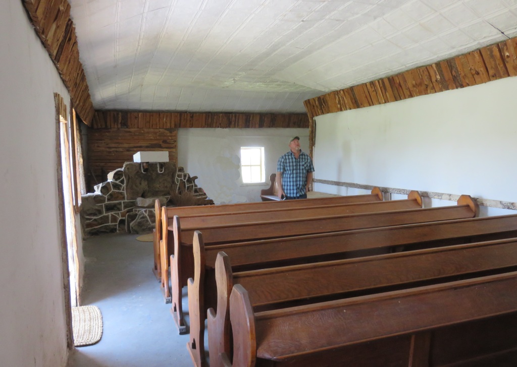 The little crossroad church, about 15km out of town. It is a NG Sendings kerk, that was the missionary arm of the Dutch Reformed church.
It was a farmhouse before the Boer war and was turned into a Blacksmith workshop, stood empty for some time and was refurbished in 1964 to be used as a church by the black NG community.
Old cemetery
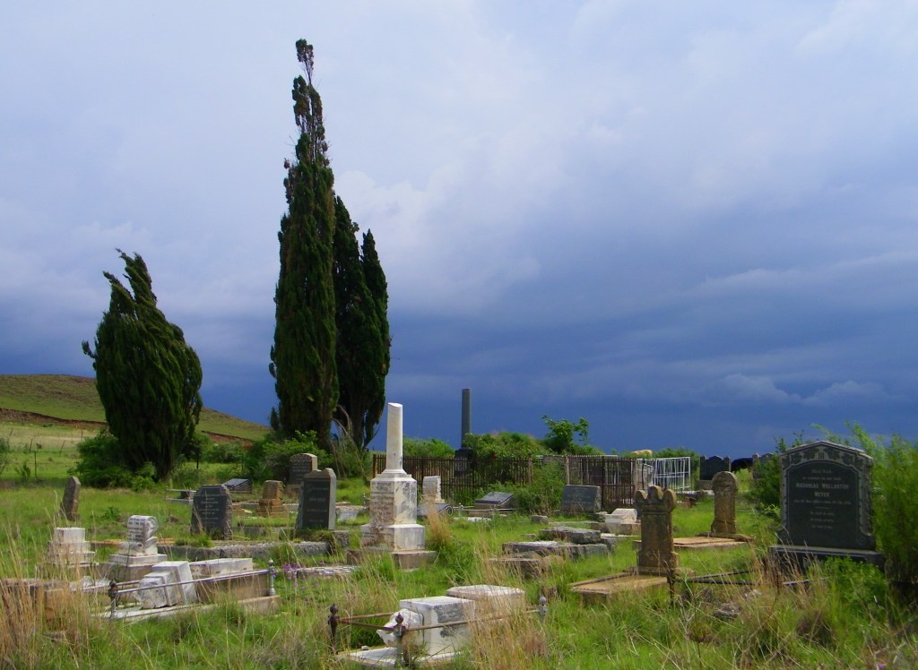 Yes, there is an old and a new cemetery, The new one is on the east side of the R57 as one passes the town. It didn't hold much interest for us. The old one is near the silos and is certainly worth a visit, if you are that way inclined.
Railway station
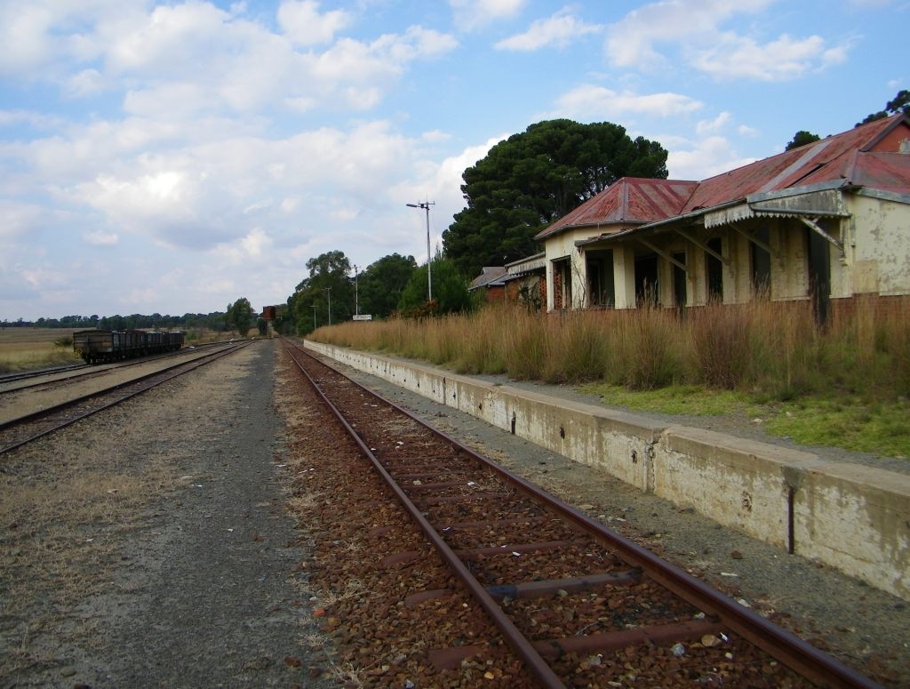 The railway came to town in 1925, this was through a rail link to Heilbron. Later in the 1930s the line was extented further to Lindley and to a connection with the main line at Arlington. At present the rail is not in use, although there is talk of a revival. In the meantime all the station building along the line are derelict, just like the one in Petrus Steyn.
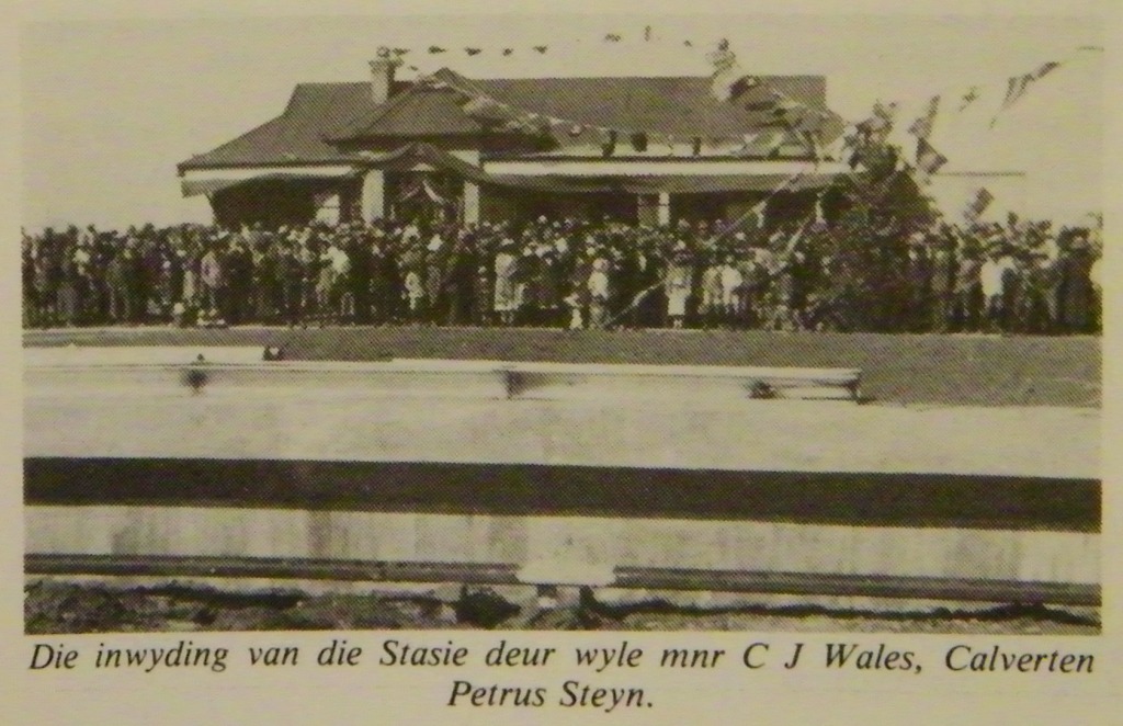 The first picture shows the station when it was officially opened in 1925, the second picture of what it looked like during our first visit in 2010.
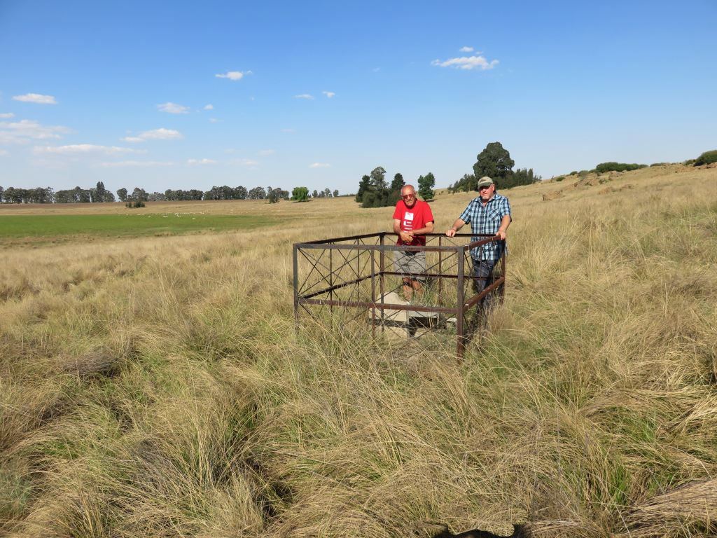
Elandskop
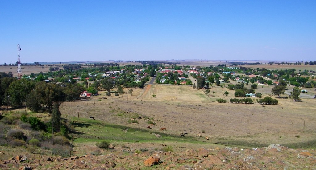 Elandskop 1763m is the hill behind the town. From there one gets a good view over the town.
Voortrekker Spa
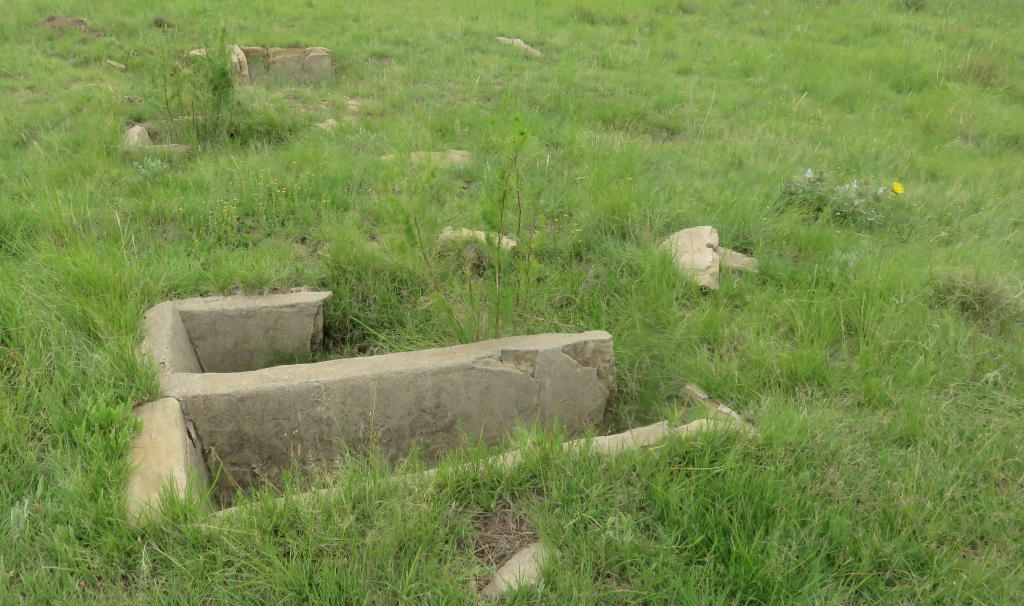 The name above is just to draw attention, it was known as Bornman's Bad and is on the farm by the same name. 30km by road from Petrus Steyn, 20km west of Petrus Steyn and 22 km north of Lindley as the crow flies. During an inspection visit in Feb 2018 it turned out to have been a fairly extensive operation. What is still visible are the foundations of a number of buildings, the bath tubs and a hand pump. The pump, I think, was a later addition, installed when the fountain didn't provide enough water.
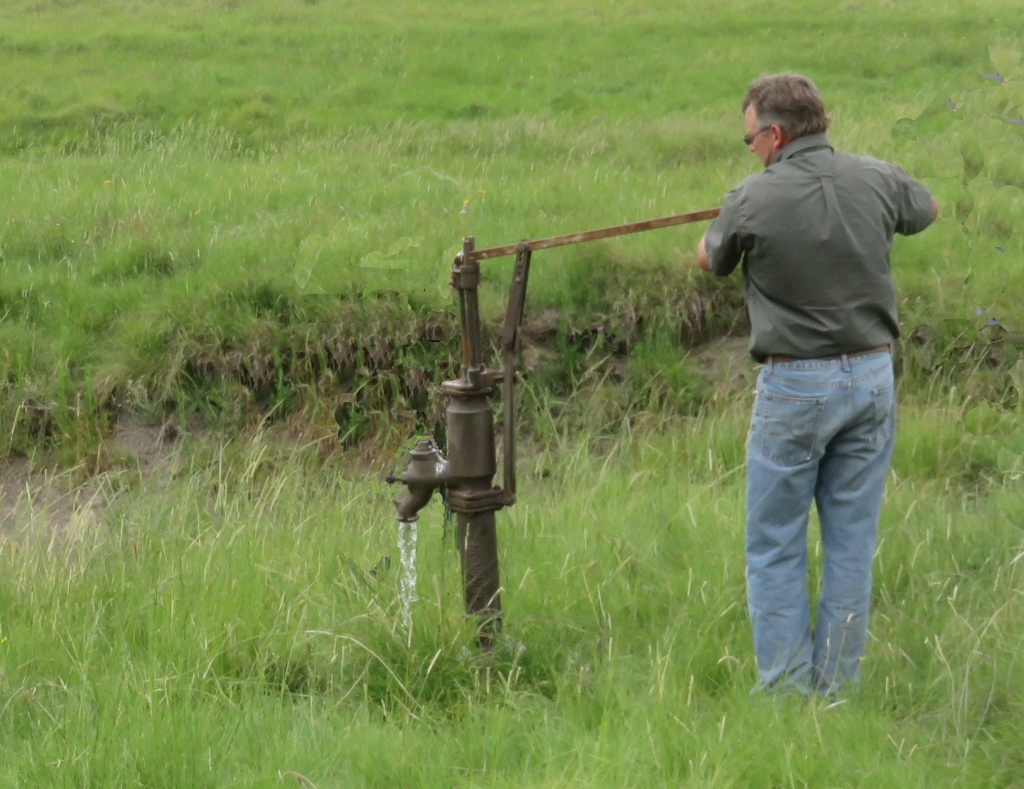 The water was reputed to cure all sorts of ailments. When I checked the water coming from the pump it had a taste of rusty pipes, indicating a high iron content, and a whiff of rotten eggs, that would be Hydrogen Sulfide (H2S). One has to presume it is ground water passing through a coal bed.
A bit of an Internet search showed that Sulfur in the water helps with the treatment of Rheumatism and Arthritis and iron deals with iron deficiency. Thus there could well have been a benefit to partaking in the bath.
We don't know much about the history of the place. There is a sentence in the reference: 'A spa has recently been discovered a few miles to the north of Lindley, and this has made the place very popular as a health resort'. The book was put together in 1912, thus we can put the 'discovery' at 1905-1910. The reason we were told why it came to an end was because the farmer was concerned about lack of grazing for the oxen of the visitors. These were the days when a common mode of transport was still the ox-wagon, and it also served as a shelter for the night.
Basuto War grave
 On the farm Goede Hoop about 14km north from Petrus Steyn. The inscription reads, on the left side: Susanna Catharina J v Rensburg; geb 1853; vermoor deur Basutos 1865, and on the right side: Hierdie klip is aangebring deur susterkind; J.O.C.Joubert; 16-10-1980. Translated: Susanna Catharina J v Rensburg; born 1853; murdered by Basuto 1865; this stone was set by the daughter of a sister on the 16-10-1980.
There is a story that she was not the only one killed, her younger brother suffered the same fate some distance away from this place. Their parents were also attacked and presumed killed.
Putting this into a historical context. The date given for the murder was just before or during the 2nd Basuto war, which started when President Brand called up the commandos on the 9-July-1865 for action against king Moshesh. The time between the 1st and 2nd war against king Moshesh was very turbulent. King Moshesh did not fully accept the peace treaty of 1858 brokered by the governor of the Cape, Sir George Grey. The incursion into the Boer republic carried on with theft of livestock, harassment and even murder, as in this case.
A Herbert Baker house
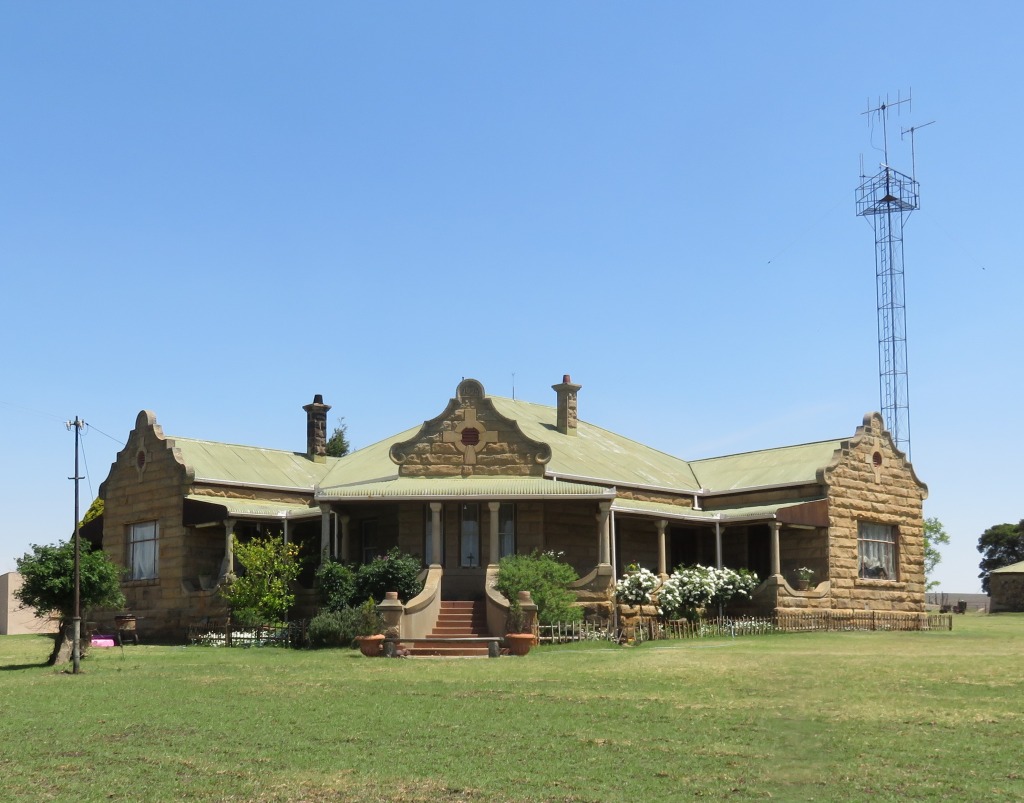
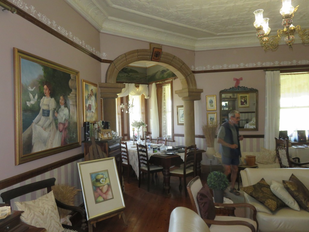 To the north-east from Petrus Steyn are a number of these beautiful sand stone residential houses. The one that we got access to belongs to the Claassen family. It was built, as stated on the gable, in 1925 and the architect was Herbert Baker, the same architect that designed the Union Building in Pretoria. Apparently there are two more residences in the area designed by the same architect, I still need to find them and also get confirmation that it was Herbert Baker.
This house is kept in the style of the era when it was constructed, inside and outside. In the past the previous owners have strayed a bit, but the present owner is planning to replace the steel framed windows with wooden frames.
Reference:
Ref 1: 'The Orange Free State - its pastoral, agricultural and industrial resources', compiled by Somerset Playne, printed by the foreign and colonial, compiling and publishing company, 1912
Ref 2: Standard Encyclopedia of Southern Africa
Ref 3: Gedenkboek van die Vyftigjarige Bestaan van die Nederduitse Gereformeerde Gemeente - Petrus Steyn 1914-1964,